Methodology
Marine Censuses
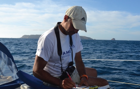
The main source of information for this atlas consists ofmarine censuses carried out from vessels throughout the Portuguese Exclusive Economic Zone (EEZ), compiled for the period between 2004 and 2012. These data enabled the creation of maps showing the distribution, abundance or probability of occurrence of seabirds.
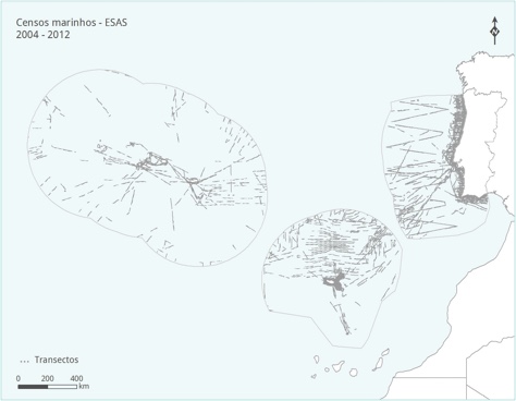
The ESAS (European Seabirds At Sea) methodology was used in these censuses, whereby data are collected along linear transects (divided into observation stations), defined by continuous observations over a specific period of time (five minutes) and expressed as densities (birds/km²). All birds in contact with the water, located within a predefined observation area, are counted. This observation area is defined by a square with 300 m sides, situated forward and to one side of the vessel, with the observer positioned at one of the square’s corners. Birds in flight are counted through instantaneous records, taken at regular intervals along the transect, so as not to overestimate their density.
Coastal Censuses - RAM Points
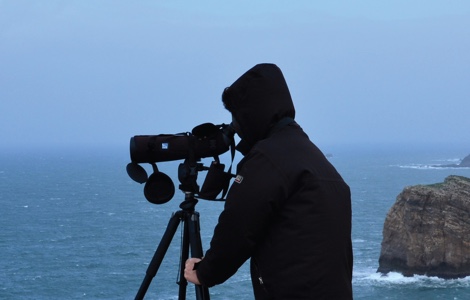
Coastal censuses – RAM points are based on the methodology established for the Seabird and Marine Mammal Monitoring Network (Rede de Observação de Aves e Mamíferos Marinhos, RAM). The information resulting from these censuses was used as an additional source of data for the Mainland.
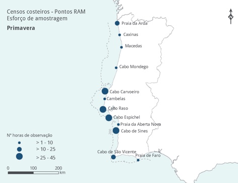
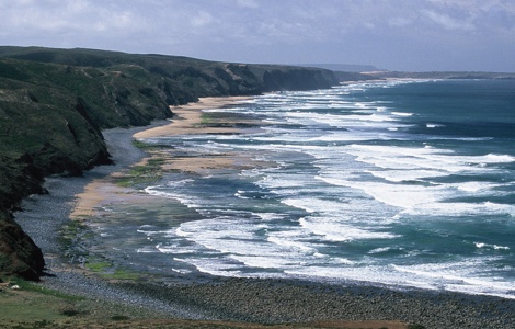
This methodology involves the observation and recording of seabirds and marine mammals from land, with censuses carried out monthly over a three-hour period. Counts are conducted at fixed locations situated on headlands and strategic points along the Mainland coast, and take place simultaneously at various points across the country. These censuses are carried out using a telescope, so as to cover 30% to 50% of the sea’s field of view. The remaining area of the sea is monitored using binoculars.
The data obtained are expressed as the number of birds per hour; therefore, the values shown on the species maps represent an average for the respective season of the year.
Coastal Censuses - Project Arenaria
Project Arenaria is a citizen science project aimed at studying the distribution and abundance of birds along the coastline, as well as monitoring their changes over time. The data collected have enabled estimates of the abundance and distribution of waders, as well as information on the distribution of other coastal bird species.
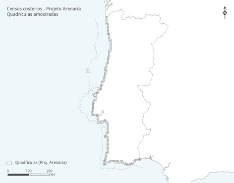
Project Arenaria methodology involves the observation and recording of birds along the entire non-estuarine Mainland coast, divided into sectors of approximately 5 km, in December and January. All birds resting or taking flight upon the observer’s approach are recorded, with reference to the type of habitat in which they are found (rock or sand). Birds perched or feeding at sea are also included, provided they are visible to the naked eye (thus excluding birds far from the coast). Birds that appear to be merely passing through, without using the grid area for resting or feeding, are not counted.
A rocky, steep and prominent geographical area that projects into the sea, often forming a cape. Glossário:
Coastal observation network for seabirds and marine mammals, based on systematic counts along the coastline. Glossário:
Standardised methodology for counting seabirds from vessels (“European Seabirds At Sea”), used to estimate distribution and density on the open sea. Glossário:
Standardised bird counts carried out at sea to estimate abundance and distribution. Glossário:
A group of birds associated with coastal or inland wetlands, generally found in habitats such as mudflats, saltmarshes, estuaries, lagoon margins, sandy areas and flooded zones. Some of these species also use the sandy and rocky coasts of Portugal. Glossário:
Under the United Nations Convention on the Law of the Sea, coastal states are entitled to declare an EEZ comprising maritime area beyond their territorial waters. The national EEZ is delimited by an imaginary line situated 200 nautical miles from the coast, separating national waters from international or shared waters. Within its EEZ, each state has rights such as the exploitation of marine resources, the conduct of scientific research and the regulation of fishing by foreign vessels.